1900 VICTORIAN MAP ~ TRANSVAAL ORANGE RIVER COLONY NATAL SWAZI LAND WATERBERG
Rated 3 out of 5 based on 3 customer ratings
$42.22
100
Return shipping will be paid by:Buyer Refund will be given as:Money Back Item must be returned within:14 Days All returns accepted:Returns Accepted Restocking Fee:No
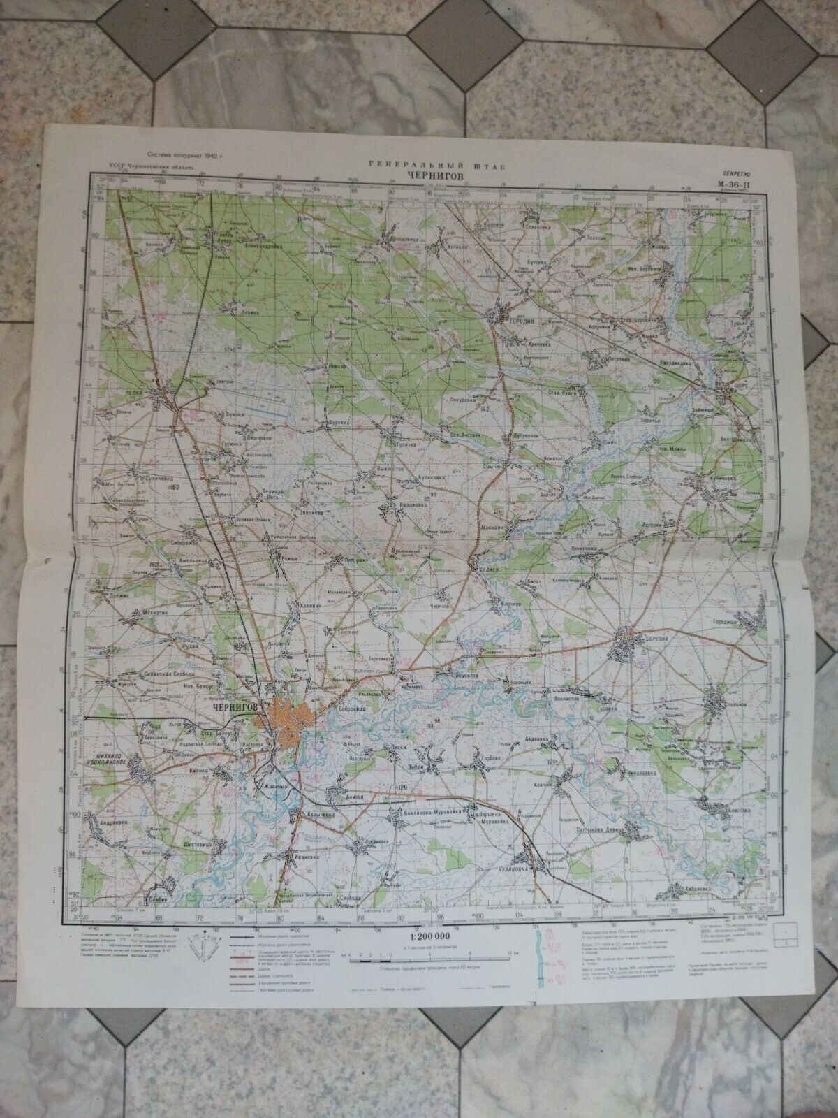
AN ORIGINAL VICTORIAN MAP RESCUED FROM A DISBOUND ATLAS 1900 THIS IS AN ORIGINAL MAP AND OVER 115 YEARS OLD AND NOT A LATER REPRODUCTION Approximate size ~ 11 inches by 8 1/2 inches (280mm x 215mm) Please view image to see any age/handling marks, stains or spotting ~ if in any doubt please message for a condition report on this specific print Condition ~ GOOD condition MINOR HANDLING/AGE MARKS AT EXTREMITIES There will be another map on the reverse of the print BEST OFFERS PLEASE FOR A QUICK SALE AT A FAIR PRICE If you like the item, but do not like the price, then make a realistic offer to us using the MAKE OFFER BUTTON WR (WW1900) singleside AN ORIGINAL VICTORIAN MAP RESCUED FROM A DISBOUND ATLAS 1900
THIS IS AN ORIGINAL MAP AND OVER 115 YEARS OLD AND NOT A LATER REPRODUCTION
Approximate size ~ 11 inches by 8 1/2 inches (280mm x 215mm)
Please view image to see any age/handling marks, stains or spotting ~ if in any doubt please message for a condition report on this specific print Condition ~ GOOD condition MINOR HANDLING/AGE MARKS AT EXTREMITIES
There will be another map on the reverse of the print
BEST OFFERS PLEASE FOR A QUICK SALE AT A FAIR PRICE If you like the item, but do not like the price, then make a realistic offer to us using the MAKE OFFER BUTTON
WR (WW1900) singleside AN ORIGINAL VICTORIAN MAP RESCUED FROM A DISBOUND ATLAS 1900
THIS IS AN ORIGINAL MAP AND OVER 115 YEARS OLD AND NOT A LATER REPRODUCTION
Approximate size ~ 11 inches by 8 1/2 inches (280mm x 215mm)
Please view image to see any age/handling marks, stains or spotting ~ if in any doubt please message for a condition report on this specific print Condition ~ GOOD condition MINOR HANDLING/AGE MARKS AT EXTREMITIES
There will be another map on the reverse of the print
BEST OFFERS PLEASE FOR A QUICK SALE AT A FAIR PRICE If you like the item, but do not like the price, then make a realistic offer to us using the MAKE OFFER BUTTON
WR (WW1900) singleside